Following on from SSJ Descent: Innocent but deadly, I theorized on how the plane could innocently made the descent, and how the ATC could also be blameless for authorizing the descent. That article does not explain how it ended up hitting the mountain. In this article I am showing where it crashed, but not how it ended up there. This accident is already very tragic, but criticism on the pace of the salvage efforts, like many other things in this accident, irks me. Let me add to the tragedy a little bit: the aircraft ended up at possible the worst place in the whole mountain!
So, where did it end up? Coordinate information given so far vary. The variation of these coordinates led to some locations that fed more speculation, etc.
Let’s start with what we have… this photo:
Now, to find the exact location is impossible. Maps for Java are relatively accurate, but for Indonesia as a whole, it’s a nightmare! Hey, I should know, I used to be in the mapping business remember? Ironically, how I started mapping and flying at the same time, all started by flying between Mount Salak and Mount Pangrango 9 years ago! One of the best free resource we have today is Google Earth. The nice 3D feature enables us to do things that until recently are limited to expert GIS people.
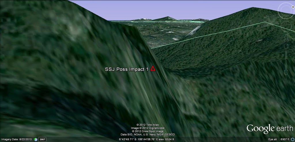
Finding the location starts by trying to match the photo, with running around Mount Salak on Google Earth using various angles, heights, and viewpoints, and then narrow down the possible sites one by one. The strange thing is, only 1 place matched the photo… this:
Where is this location? On Google Earth, the red triangle there, is at 6°42’48.14″S 106°44’8.44″E.
This is a plan view of the location.
Why do I say it is the worst place in the mountain?
- It is located near the peak of the mountain.
- The terrain wall it hit, is amongst the largest in terms of height from top to bottom, in the whole mountain, and it is one of the steepest.
- It is in a narrow confined location.
This makes the impact site difficult to spot even from the air, let alone from the ground. Access to the site is also very difficult. What makes it worse (and worst of all), the narrow confinement of the location, not only access is difficult (by land or air), retrieving anything from there and bringing it elsewhere is a huge challenge. I guess the slow progress of the SAR team is testimony of the difficult situation.
From the previous article SSJ Descent: Innocent but deadly , I wrote about how the crew might not realize that Mt. Salak was there. However, the explanation in that article, makes it extremely difficult to reconcile with the crash site. The trajectory from that analysis, would yield an impact from the north east or from the east. On the photo of the crash site on the cliff wall, it should show a predominantly left-to-right trajectory, but the photo shows impact characteristics that relatively right-to-left, which means, the aircraft had to come from the north and at relatively high speed (300 knots ground speed is just within “high speed impact” category in my books). BUT… details of the crash site, description of the bodies found, description of “engines relatively intact”, etc, all point to a low to medium speed impact.
Therefore, there HAS to be a different theoretical trajectory for the aircraft that is different from my previous article. It looks like I found it just now… but it’ll take time for me to write it as I need to take time to make sure it looks plausible, and doesn’t break my own ethical boundary for “objective speculation.”
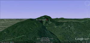
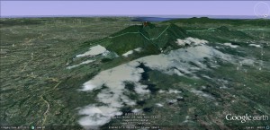
In the meantime, here are some more Google Earth images on how the impact site looks from the north:
The impact site from the east. Coming in from the east does not match the impact site characteristics, and they should have hit the ridge before the crater instead if they were to crash.
An incoming path from between north and north east, is a lot more likely. There is a lot of space for them to end up hitting the cliff, without too many probable incoming paths.


Can you draw the suspected flight path, so not to confuse us. With arrow to show the direction if possible, thanks. 🙂
When I see your previous blog entry, I suppose the plane hit the cliff wall from either the northeast edge or southwest edge (since I don’t know when did they started to descend exactly).
But in this entry, you showed us that the cliff wall is indeed facing northeast. And God knows how the plane made an impact.
What can I comment is: THEY WERE THAT CLOSE! A couple of feet away, they would have cleared that cliff wall. It is tragic and very difficult to accept. 🙁
There will be another article coming soon, based on information I just received today on the flight path of flight 1 as a basis for flight 2, similar to the previous article, but the resut is coming in to the wall from north-north-east. This new theory is probably the most probable, but needs validation from tests (ongoing at the moment). Will post hopefully tonight.